Unit 1- The Geography of Georgia
SS8G1 Describe Georgia’s geography and climate.
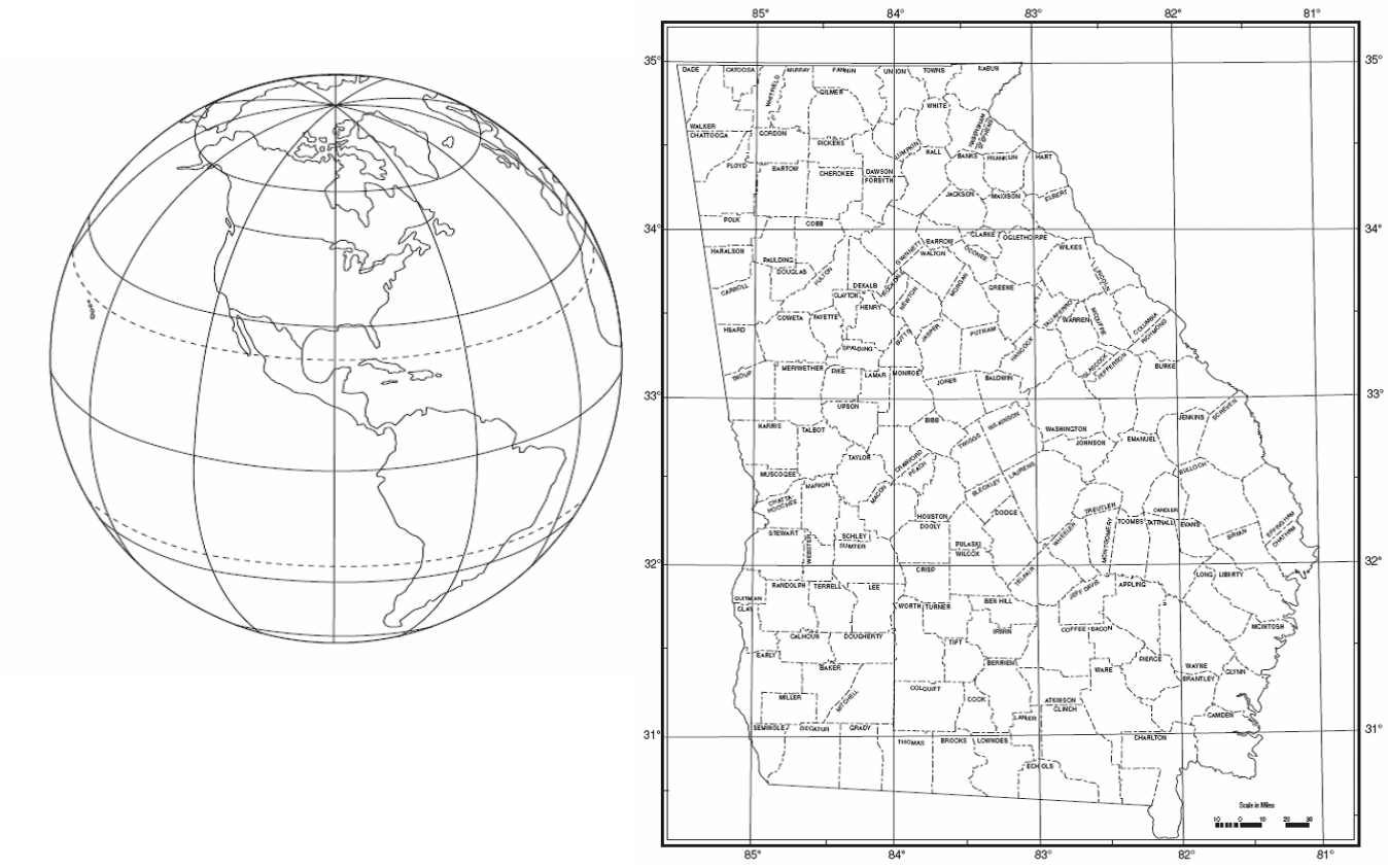
A. Locate Georgia in relation to region, nation, continent, and hemispheres.
B. Distinguish among the five geographic regions of Georgia in terms of location, climate, agriculture, and economic contribution.
C. Locate key physical features of Georgia and explain their importance; include the Fall Line, Okefenokee Swamp, Appalachian Mountains, Chattahoochee and Savannah Rivers, and barrier islands.
D. Analyze the importance of water in Georgia’s historical development and economic growth.
Geography Basics
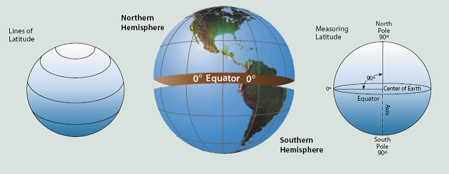
Latitude: Notice how lines of latitude are based off off of four points: North Pole, South Pole, Earth's Axis, and the Equator. Lines of Latitude never touch, hence the alternate name "Parallels". Latitude is measured from 0 to 90 degrees North and 0 to 90 degrees South.
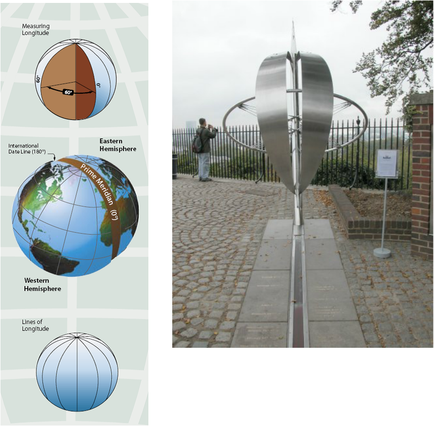
Longitude: Longitude is measured from 0 degrees (Prime Meridian) to 180 degrees East and 180 degrees West. These lines are not parallels as they touch and the North and South Poles. The Prime Meridian is based out of the Royal Observatory in Greenwich, England.
Lattitude and Longitude: When you put them together you get absolute location.
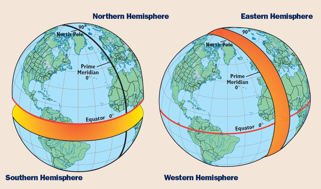
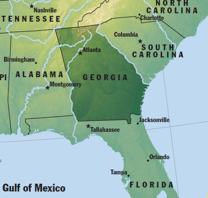
Georgia's location is in:
- the Northern Hemisphere
- the Western Hemisphere
- the North American continent
- in the United States of America
- the Southeastern U.S., The South, The East Coast, The Sun Belt, The "Deep South"
Georgia's location is in:
- the Northern Hemisphere
- the Western Hemisphere
- the North American continent
- in the United States of America
- the Southeastern U.S., The South, The East Coast, The Sun Belt, The "Deep South"
Georgia's Physiographic Regions
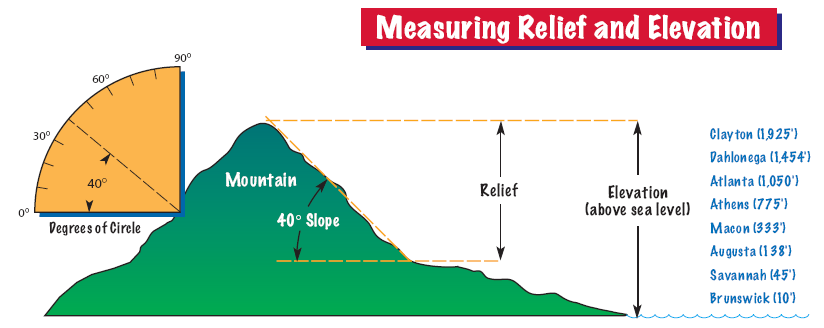
Elevation is height above sea level, whereas, Relief is difference in elevation within a landform (such as the height of a mountain from its base to its peak). Elevation influences not only temperature, but also precipitation.
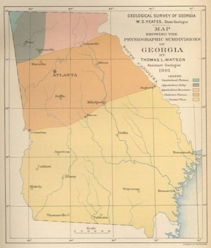
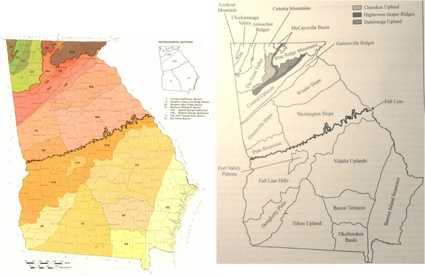
Physiographic regions are based on land formations, elevation, rocks and minerals, soil, and climate. Georgia is crossed by the Coastal Plain, Piedmont, Blue Ridge, Ridge and Valley, and Appalachian Plateau (sometimes called the Cumberland Plateau).
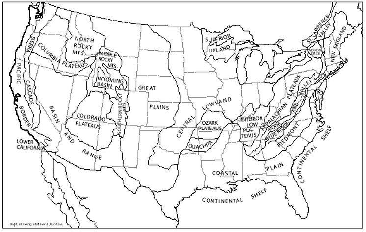
There are 25 physiographic regions in the continental United States (26 including the continental shelf)...Alaska has 4 and Hawaii, 1.
There are 25 physiographic regions in the continental United States (26 including the continental shelf)...Alaska has 4 and Hawaii, 1.
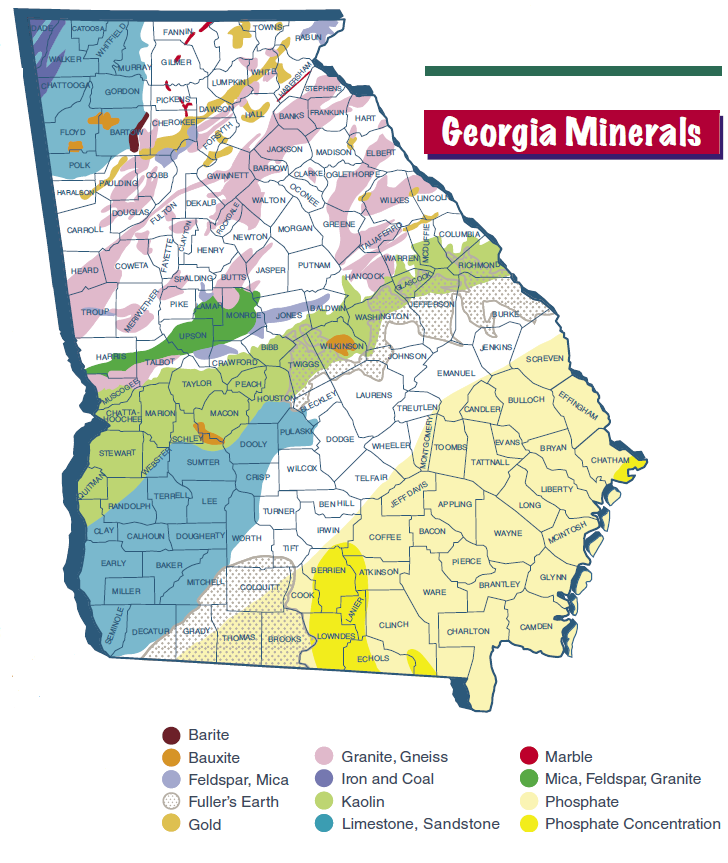
Rocks and minerals have also played a large role in the development of Georgia. Georgia is the world leader of kaolin production (used in the production of glossy paper) and national leader in marble production. Of course, gold brought early explorers such as Hernando de Soto (in 1540) and eventually hastened the removal of the Cherokee Indians in the 1830s.
The Fall Line
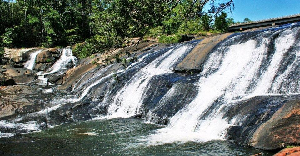
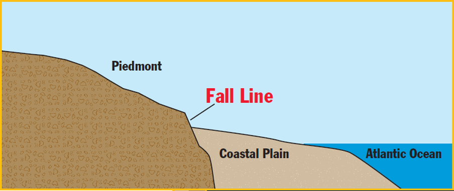
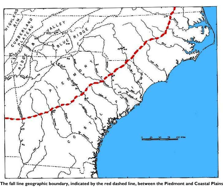
The Coastal Plain region is separated from the Piedmont by a natural boundary known as the Fall Line. The Fall Line is the point at which hilly or mountainous lands meet the coastal plain.
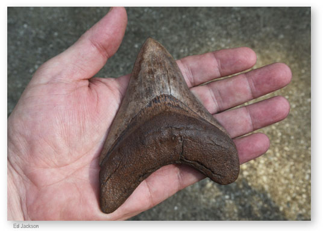
This zone actually marks the prehistoric shoreline. It is not unusual to find prehistoric fossils as far inland as Macon or Columbus. Land to the north of the line is higher in elevation than that to the south, causing rivers to pick up speed as they travel. This drops the elevation and creates waterfalls. As early settlers began to leave the coastal regions and explore inland, many were forced to stop at the Fall Line because they could not travel over the steep and rushing falls. These early settlers, as well as Indians and traders, found the waterfalls an excellent power source and built settlements there. As a result, many of Georgia's oldest cities (such as Columbus, Macon, Milledgeville, and Augusta) are located along major rivers at the Fall Line.
This zone actually marks the prehistoric shoreline. It is not unusual to find prehistoric fossils as far inland as Macon or Columbus. Land to the north of the line is higher in elevation than that to the south, causing rivers to pick up speed as they travel. This drops the elevation and creates waterfalls. As early settlers began to leave the coastal regions and explore inland, many were forced to stop at the Fall Line because they could not travel over the steep and rushing falls. These early settlers, as well as Indians and traders, found the waterfalls an excellent power source and built settlements there. As a result, many of Georgia's oldest cities (such as Columbus, Macon, Milledgeville, and Augusta) are located along major rivers at the Fall Line.
Georgia's Coast, Waterways, Weather and Climate
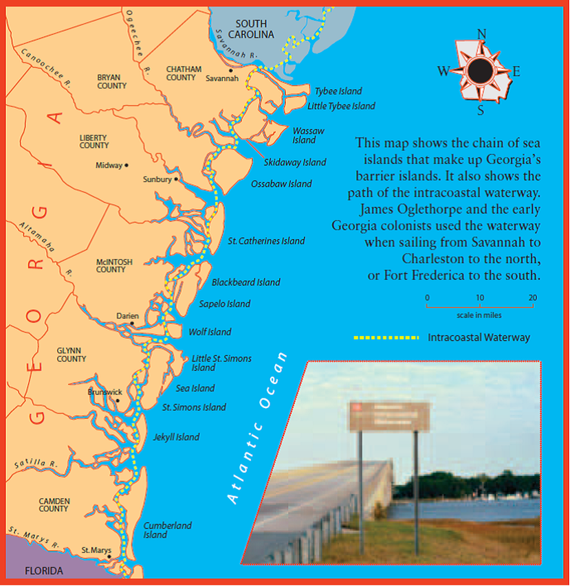
Georgia's chain of sea islands are called "barrier islands" because they form a barrier, or wall, blocking ocean waves and wind from directly hitting the mainland. They are sometime called the "Golden Isles" because early explorers expected to find gold there. Later, the name took on another meaning as millionaires from the North began buying these island and building spacious winter homes there in the 1800s. Today, many of these islands are protected by the state and federal government.
|
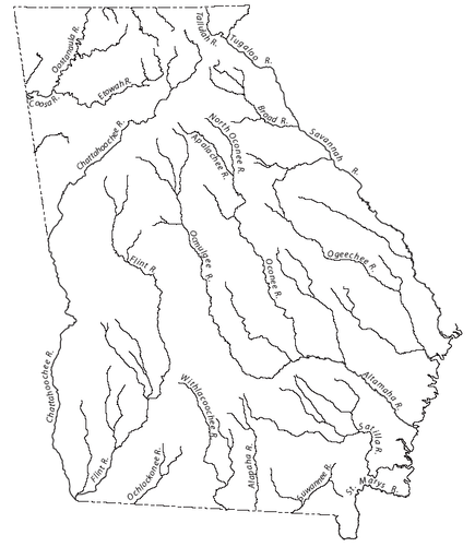
Rivers are one of Georgia's most important resources...
...they provide drinking water to half of the states population. ...they are used by many different industries (most notably carpet manufacturing). ...they are essential for wastewater disposal. ...they are used for transportation. ...they are important for fishing, boating and other types of recreation. ...they are habitats for wildlife. In Georgia's history, rivers... ...were used to generate power for mills before electricity. ...affected the location of settlements. ...were frequently used to mark county boundaries, and... ...were selected to form part of Georgia's boundaries with Alabama and Florida, and all of its boundaries with South Carolina. |
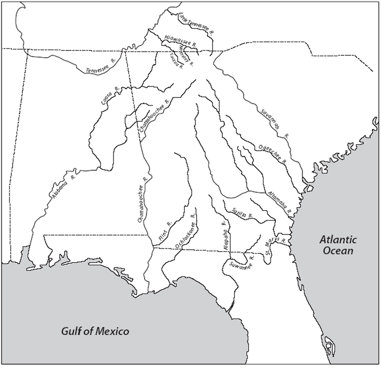
Notice that most of Georgia's rivers in the east empty into the Atlantic Ocean...many rivers to the south and west empty into the Gulf of Mexico due to their location in relation to the continental divide.
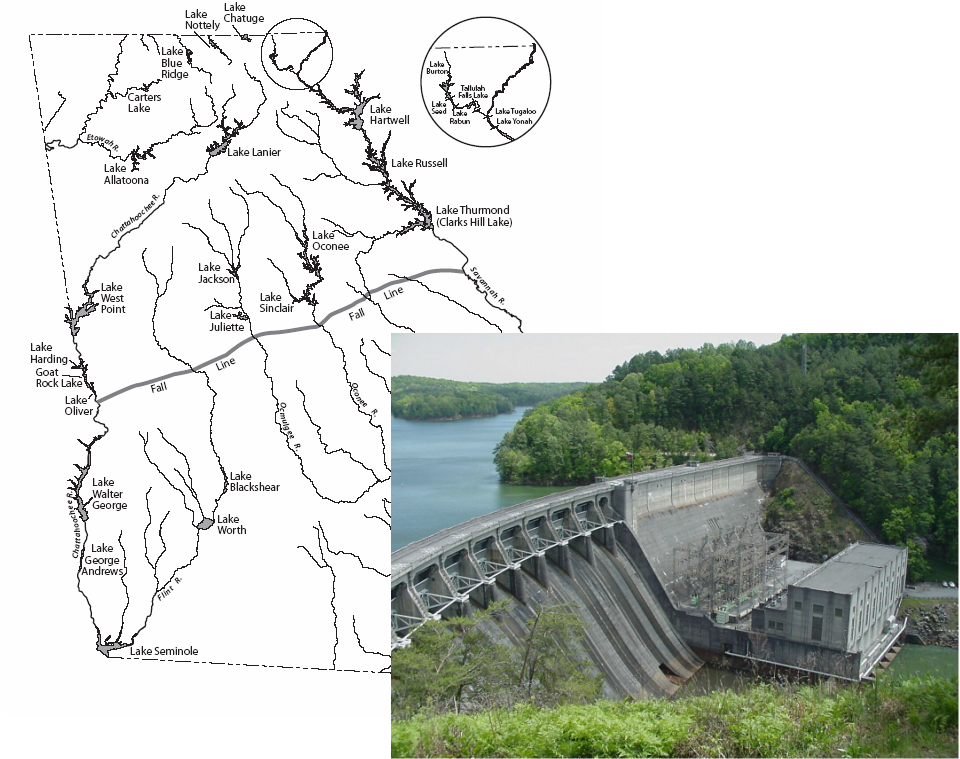
Most of Georgia's lakes are located north of the Fall Line for two reasons:
1. Most Georgian live north of the Fall Line (70% of all Georgians)
2. There is no major underground source of water
- The lakes are artificial in nature and have been build within the 20th century to accomodate Georgia's growing population.
- Georgia's dams and reservoirs convert flowing water for electricity...they also prevent flooding, supply water to nearby cities, provide downstream navigation, provide recreation, and are important to fish and wildlife conservation.
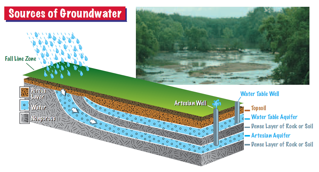
Groundwater- South of the Fall Line, water for cities, irrigation, and other uses come from groundwater in artisian aquifers. Here, because of make up of the earth below the surface (sedimentary beds of sand and porous rock such as limestone), the ground can store vast amounts of water called groundwater. Water-saturated layers of earth are called aquifers.
There are two types of aquifers:
1. Water Table
2.Artesian
There are two types of aquifers:
1. Water Table
2.Artesian
Weather- refers to the day-to-day conditions in the atmosphere.
Climate- refers to the average weather conditions over time- at least 25 to 30 years.
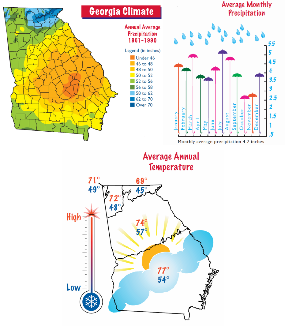
Georgia's climate is determined by its geographic location...it is near the Atlantic Ocean and Gulf of Mexico, and the eastern edge of the continent...combined with Georgia's closeness to the Equator the result is hot summers, mild winters, and, in most years, abundant rainfall throughout the state. Generally, there is a wide range between the highest and lowest temperatures during the year with Summer being the longest season. Summers have high humidity and high temperatures, while Spring and Fall are mild. Winters are generally short and mild, although there may be several cold spells each year...while snow may fall, particularly in the higher elevations, it usually melts within a few days...Lakes and rivers seldom freeze over. Precipitation is spread over the year, although not uniformly.
- Notice that the vast majority of rainfall occurs in the Blue Ridge region of Georgia.
Climate- refers to the average weather conditions over time- at least 25 to 30 years.
Georgia's climate is determined by its geographic location...it is near the Atlantic Ocean and Gulf of Mexico, and the eastern edge of the continent...combined with Georgia's closeness to the Equator the result is hot summers, mild winters, and, in most years, abundant rainfall throughout the state. Generally, there is a wide range between the highest and lowest temperatures during the year with Summer being the longest season. Summers have high humidity and high temperatures, while Spring and Fall are mild. Winters are generally short and mild, although there may be several cold spells each year...while snow may fall, particularly in the higher elevations, it usually melts within a few days...Lakes and rivers seldom freeze over. Precipitation is spread over the year, although not uniformly.
- Notice that the vast majority of rainfall occurs in the Blue Ridge region of Georgia.
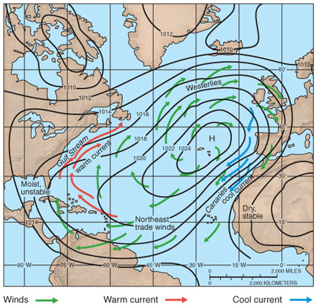
Wind and Ocean Currents: The main cause of air and water currents is the uneven heating of the earth by the sun. The sun strikes the earth most directly at the Equator and least directly at the poles. Around the earth, air is always flowing from areas of high pressure (cool air) to those of low pressure (warm air). This constant shifting creates air currents. Note that wind currents are named after their point of origin.
Similar to air currents are the movements of water masses in the ocean. Near the surface, these tend follow the general path of air currents. Water currents result from wind action and the uneven heating of the world's oceans by the sun.
Similar to air currents are the movements of water masses in the ocean. Near the surface, these tend follow the general path of air currents. Water currents result from wind action and the uneven heating of the world's oceans by the sun.
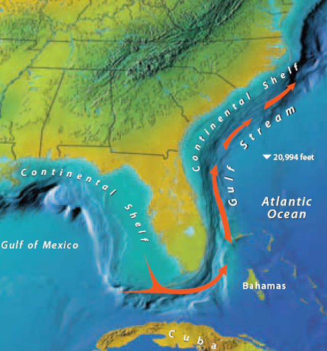
Continental Shelf- the continenal shelf is an underwater ledge that extends out 70 or 80 miles off Georgia's coast. This "ledge" drops about two feet for each mile awat from shore...after that, the sea bed drops more sharply. As you can see on the graphic, the continental shelf influences the path of the Gulf Stream (warm water current). The Gulf Stream stays in deeper water beyond the continental shelf. This influences most hurricane storms to move northward. In addition, Georgia's short, curved coastline is less exposed to the full impact of hurricanes than eith Florida or the Carolinas. Only four hurricanes have struck Georgia directly in the last century, the last being Hurricane David in 1979. The worst storm in terms of human life to hit Georgia struck Savannah in 1893.

Hartsfield-Jackson Atlanta International Airport is the conduit for 100 million passengers per year and handles more than 625,000 metric tons of cargo on 32 air carriers including Georgia’s own Delta Airlines (headquartered in Atlanta). More than 100 trucking companies expedite cargo deliveries via ground (interstate and local roads) and rail transportation throughout the state and the U. S. Three cargo complexes enable rapid handling of goods so that they can be moved to their destinations or ports by roadways and by rail. Eighty percent of the U. S. market is within a two-hour flight from Georgia. The airport’s impact on the regional economy of Georgia (particularly the Atlanta region) generates $23.5 billion per year.
|
|
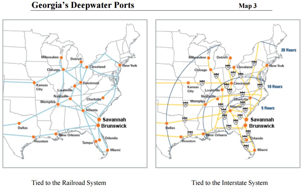
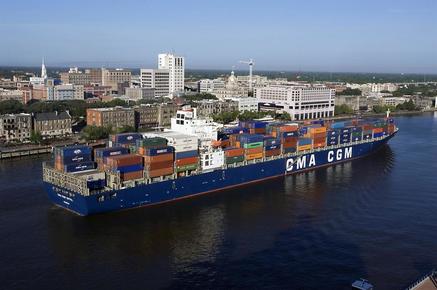
Another component of Georgia’s transportation system that is vital to the state’s economy is the deepwater ports of Savannah and Brunswick. Georgia products are exported to all parts of the world via these ports, while foreign products enter the U. S. through these ports. Governed and operated by the Georgia Ports Authority, Georgia’s ports are among the fastest growing ports in the U. S. The port of Savannah handles approximately 80% of the goods entering Georgia via ship and has immediate access to interstates I-95 and I-16. The port’s two terminals handle bulk cargoes, large containers and roll on/roll off items, such as automobiles and other wheeled vehicles. The smaller port in Brunswick handles a significant amount of products, including general cargo, bulk items, and automobiles, through three terminals. Liquid and dry bulk commodities, including chemicals and oil, are transported through these port facilities to ground transportation for delivery to Georgia and U. S. companies.
The Seven Natural Wonders of Georgia
You may remember reading about the “Seven Wonders of the World,” which included the Hanging
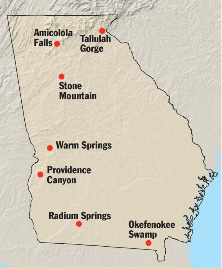
Gardens of Babylon, the Great Pyramid, and the Colossus of Rhodes. But what you might not realize is that our state also has its own “seven natural wonders.” Among the many natural features of Georgia’s topography, seven have been designated as natural wonders: the Okefenokee Swamp, Tallulah Gorge, Radium Springs, Warm Springs, Stone Mountain, Providence Canyon, and Amicalola Falls.
One of the most famous is the Okefenokee Swamp. The Okeefenokee Swamp was once part of the Atlantic Ocean floor and received its name from the Indian word o-wa-qua-phenoga, which means “land of the trembling earth.” The Okefenokee is filled with a shallow “black water” stained by the tannic acid of decaying vegetation. The swamp covers a half million acres (about seven hundred square miles) and is located in the Outer Coastal Plain near Waycross and Folkston. This primitive wetland is home to
hundreds of species of plants, animals, and reptiles, many of whom are endangered. Throughout
the area are about seventy “piney wood” islands, once home to Seminole Indians and settled by pioneer Georgians in the 1850s.
